
Schein & Schein Old Maps
For People Who Love Maps
Shop Now
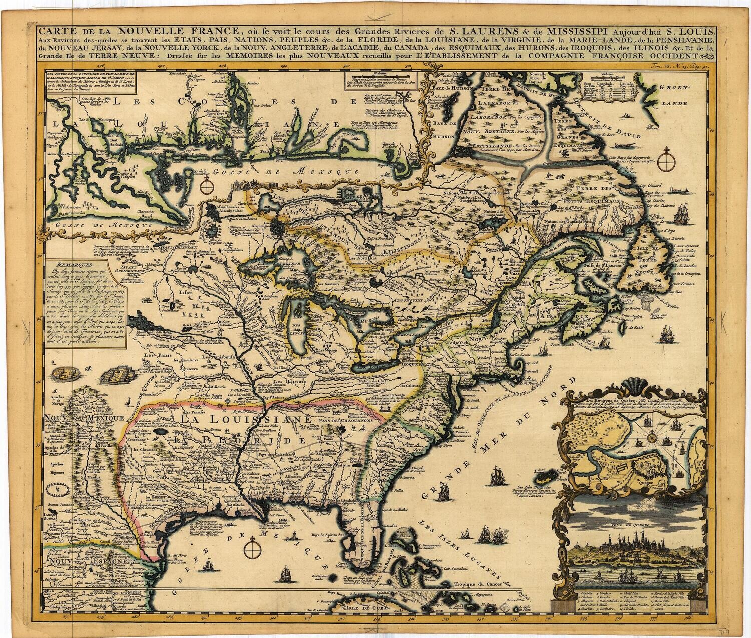
1719 Carte De La Nouvelle France by Henri Chatelain
17.25 x 20.5" Original folio map of "New France" from Henri Chatelain Atlas of 1719 . Its title is over 6 feet long laid out and contains 96 words w/ 25 punctuations and claims to cover rivers and waterways within the "states, nations and peoples of : FL., La. Md. Va. Pa. Nj Ny. New England, Arcadia , Canada, Esquimaix, Hurons, Iroquis, Ilinois & grand Isle of new World , from the latest authorities in the establishment of the French western company
Carte De La Nouvelle France, et le cours de Grand Rivieres: Saint Laurens, Mississippi Et St Louis, etc. is an early look into what is known by King Louis XV of the region and the creation of this map under his regent Philippe II d'Orleans asserted his right to rule and sell the land under his dominion within this map. Details of the Great Lakes , Rivers and native peoples is well regarded . A fur trader and explorers map , produced to reinforce claims of dominion and raise money to support the state . Insert map of Quebec and its environs at lower right
Consider making a reasonable offer on this map if the price is too dear, check the competition and come back with a number your comfortable with.
Excellent period hand water color compliments this desirable and popular map of Eastern and Midwestern Canada and The US.
Fine Condition , original tipping removed without detriment, Full folio , nice margins
Always striving to bring a selection of maps to meet most map lovers needs.
Images for all inventory is an on-going project so let us know if image is necessary to make your purchase. Thank you!
