
Schein & Schein Old Maps
For People Who Love Maps
Shop Now
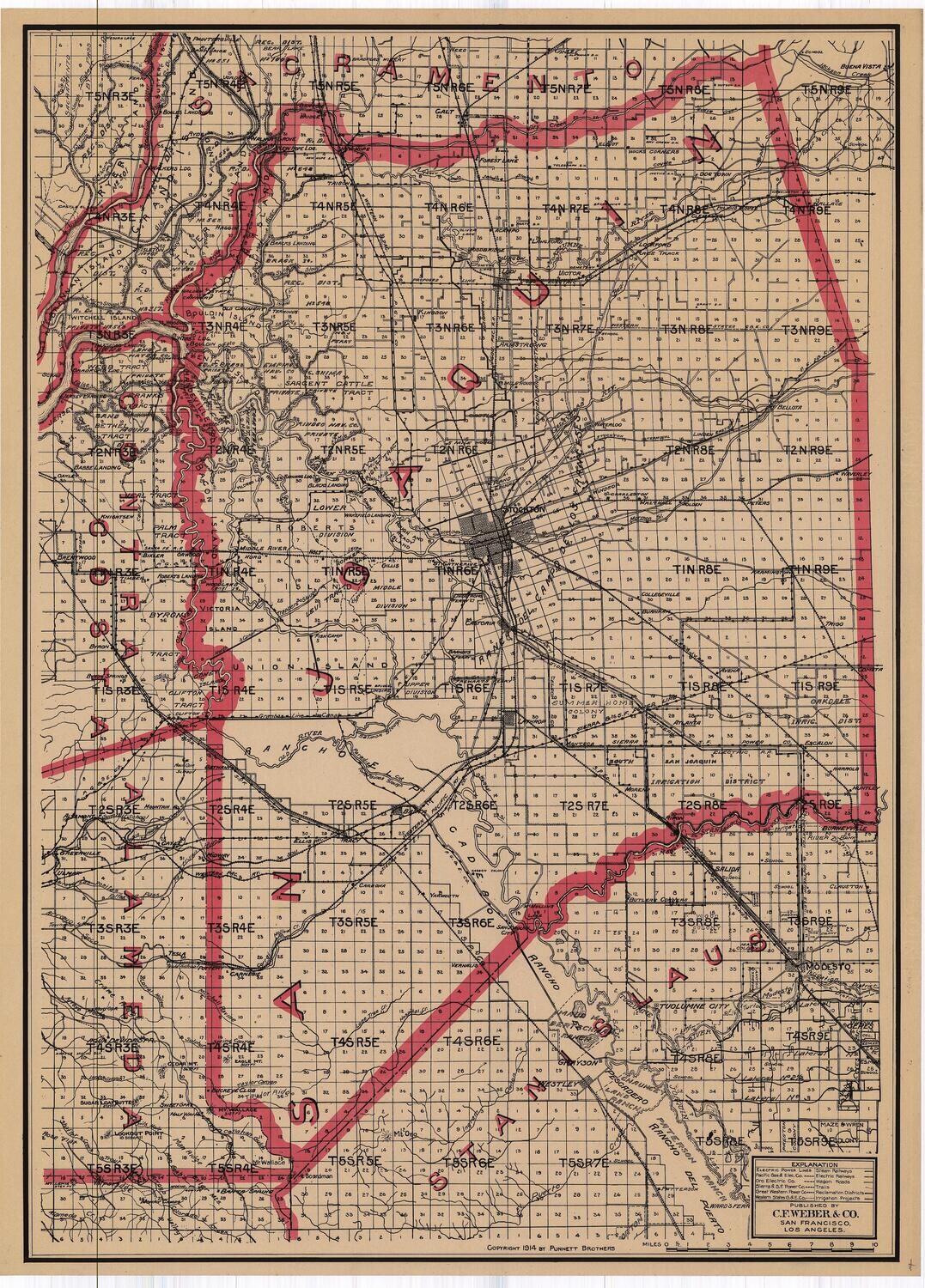
1914 Map of San Joaquin County by CF Weber in 2 Color Lithography
Copyright, 1914 by Punnett Brothers, published by C.F. Weber & Co. In fine condition with age appropriate wear. Measures approximately 27 1/4 x 20 inches.
More information on the map and C.F. Weber / Punnett Bros:
These original period documents are 2 color lithographs and are produced from the drafting skills, survey work and confirmation studies of John & Ernest Punnett, known as successful producers of highly accurate, confirmed title and cadastral maps, for professional uses by title companies and subsequent publishers like C.F. Weber, Metzgers and Denny.
During this period of time, federal law required county surveyors to file annually with the state, all new details and information relating to the sale and ownership, size and boundaries of lands within each county.
This allowed a great deal of information to be available to the Punnett Bros. for the adaptation and use in commercial maps.
These are commercial maps, made for business interests, for the exploitation of resources and with the confirmation of ownership provided, investment into power production and transportation via electric, coal and oil companies within the state. Farmers, land developers, environmentalist, loggers, miners and engineers all used these maps for their daily work within these areas.
Condition on these is the best one will ever see, based on proper storage for over 100 years and a known history of appreciation of the value. Truly fine, near pristine is the general condition rating, with commercial paper made for either folding into a covered pocket map or linen backing for wall map production. Most maps of this age don't survive as they are used into disrepair, in either function.
Price based on population density and availability of possible redundancy or similar issue within our collection, there is great value in these maps, for their price point and contribution to the overall understanding of the nature of transportation, energy, roads, people and populations of the time. Land ownership is documented in these maps better than any others of the time, with outlined boundaries, acreage and names attached to taxes listed.
Always striving to bring a selection of maps to meet most map lovers needs.
Images for all inventory is an on-going project so let us know if image is necessary to make your purchase. Thank you!
