
Schein & Schein Old Maps
For People Who Love Maps
Shop Now
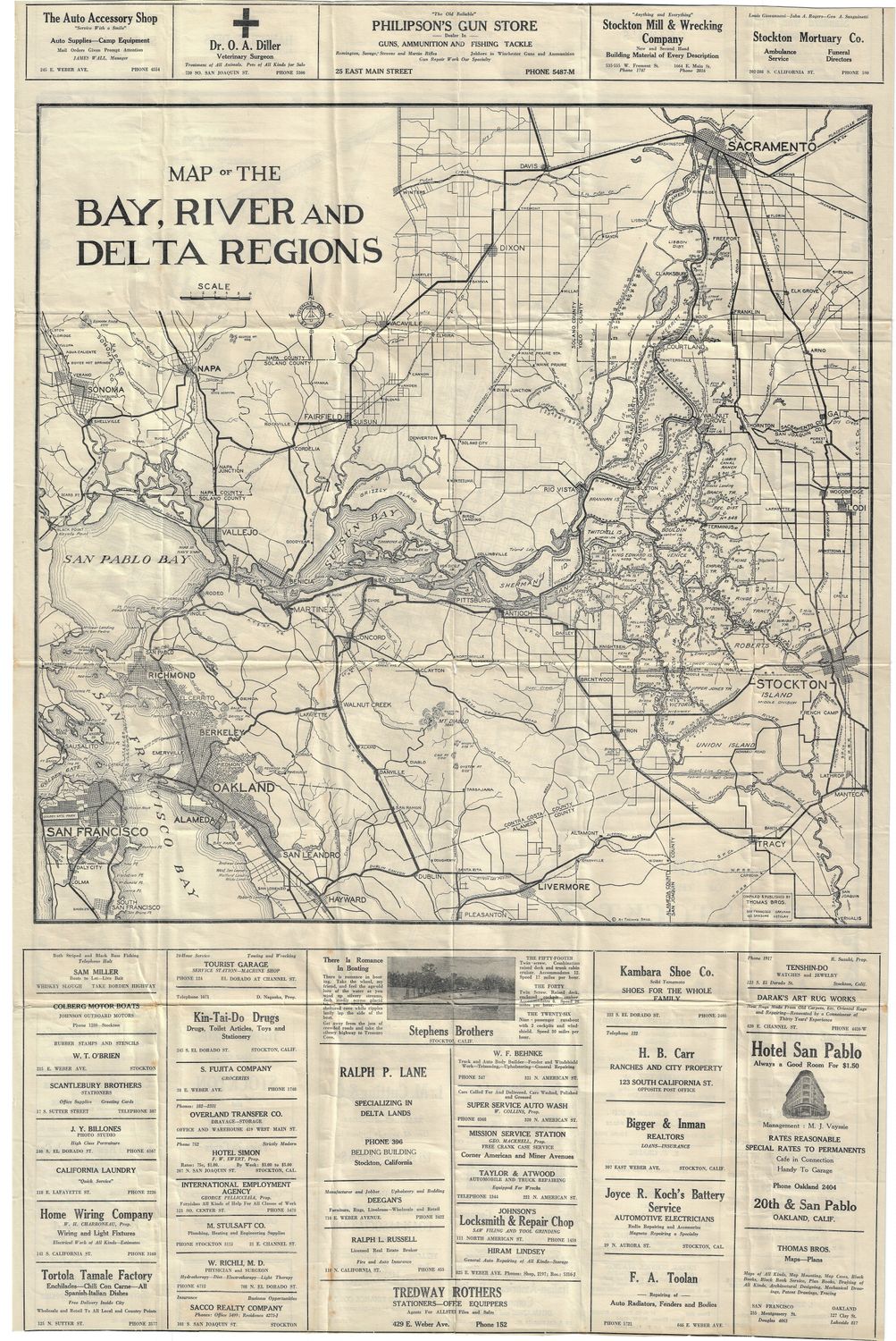
1930 Map of the Bay , River and Delta Regions by Thomas Bros.
1930 Map of the Bay, River and Delta Regions by Thomas Brothers, local mapmakers with their main office at this time located on Sansome st, SF. An early map pre-dating the San Francisco bridges, but post-construction of the Carquinez bridge. A folding map, showing the city of Stockton on reverse w/ manuscript additions in red and including advertisements for Stockton businesses on both sides. Rare for its comprehensive coverage of the whole delta region of California, all the way up to Sacramento. Map is in fine condition. 33 1/4 x 21 1/2 inches.
Always striving to bring a selection of maps to meet most map lovers needs.
Images for all inventory is an on-going project so let us know if image is necessary to make your purchase. Thank you!
